View Larger Map
Sam and I left for James Bay on Friday night. We’d been planning for a couple of months to travel to Chisasibi, a native town on the northeast corner of the bay. It’s a fairly simple, if long ride. After winding your way 670 kms from Ottawa to Matagami, you get on the James Bay Highway and drive north on the same road for 600 kms. Some time after passing the 52nd parallel you turn left and head to the Bay. However, we decided to complicate the trip. We would first head to Chibougamau, 250 kms north of Lac Saint Jean, and then travel the Route du Nord 400 kms to the JBH.
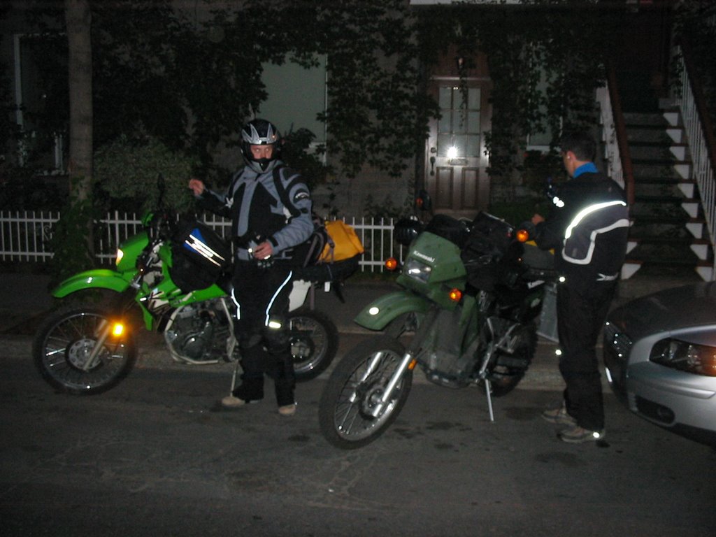
We suited up on Friday night and left later than we should have. Michael Ignatieff is to blame, but that is another story.
Leaving the Plateau
We rode through a heavy rain as far as Trois Rivieres, and then turned north for Shawinigan. I watched Sam avoid a collision on a combined on/off ramp. I soon did the same. Add another small blessing to the pile.
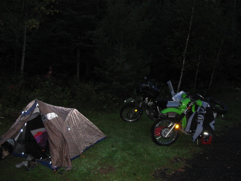
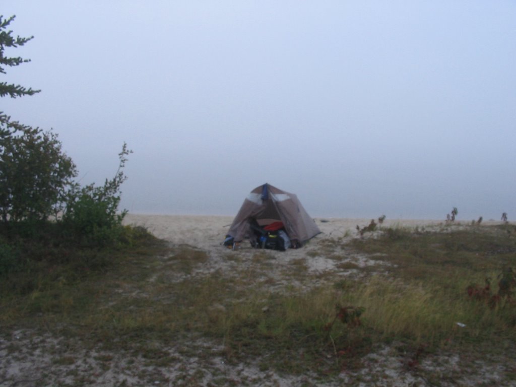
The bikes performed admirably, as did my gear. Pushing through the rain at 110, I was quite certain I was prepared for the elements farther down the road. After a couple of hours of solid and straight riding we stopped in Shawinigan for dinner. We had set reaching Roberval as our goal, but night and fatigue overcame our best intentions. Winding along the Grane Mere, we finally stopped in Parc des Chutes, just south of La Tuque. We’d pushed 300 kms through the fog and rain. We quickly found a patch of grass beside a parking lot and set up tent. My head went down at 2 am only to be followed by a fitful sleep. I was nervous about the North Road.
Camp in the morning
Sam and I were both awake at 6 am. I think his sleep was like mine. We were both staring down a long day in the saddle and we both wanted to make time. We packed up and scored breakfast in La Tuque at a small truckstop. We then saddled up and pushed into grey clouds and fog.
The gray lifted as we crested a hill over Lac St Jean. Lucien Bouchard once said he would have been a federalist if he had visited Vancouver when he was young. Seeing the sun shine over the Saugenay, with blue mountains across the lake and farm land stretching out forever I was for a moment a sovereigntist. This is enough beauty for one country.
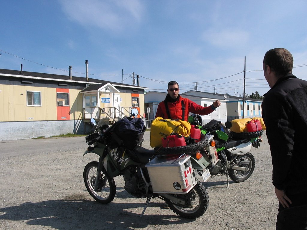
We turned left at Roberval and stopped in at a Canadian Tire for some gear additions. It was noon by now, but we were still cold. We bought more gloves and hot packs for the ride up north. All told, would we finish the day about 450 kilometers farther north, and in near-Taiga. We tried to prepare for the worst.
After we suited up again we headed for Chibougamau, doing to 250 kms in one hit. Sam led most of the way, and I was happy to follow. He is the perfect riding partner. Cautious, but not slow. Adventurous, but not careless. And he is always willing to push a bit farther.
By late afternoon we had reached Chibo. Fifteen kilometers north of the city we found the Route du Nord. Originally built to access cut blocks and hydro projects, the road winds some 400 kms across northern Quebec, running west and then turning North. During the week, the road is filled with logging trucks. As we are running on a Saturday, we are all alone. In the 300 kms we cover on Saturday, we see less than ten cars! Mostly, it is just skimming along on top of the gravel. The guides I have read suggest observing the speed limit, which is just 70 km/h. This is clearly too slow, and soon Sam and I are pushing 110, eyes peeled for large rocks, fighting occasionally against front-wheel dives in the berms, and always keeping an eye out for animals. The bikes love this terrain. We let a distance grow between us, so we are not riding in each other’s dust. We stop to meet up ever hour or so. This is the ride we’ve been waiting for: challenging, isolated, fast, and adventurous. We grin from ear to ear.
Somewhere in the middle of nowhere
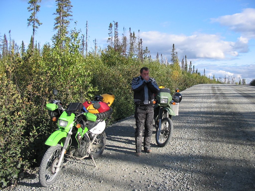
It is in the corners that the counter intuitions of a motorcycle become clear. At speed, your wheels want to slide out under the gravel, and the bike wants you to take a straight line to the outside of the corner. The mind tells you to slow down, lean forward, and steer into the corner. The mind is wrong on three counts. Rather, you punch the throttle, stand up a little on the outside peg, and push the bars away from the inside corner. The bike leans and grabs a line and shoots out the corner. Everything you thought was right was wrong.
After 250 kms the sun is diving behind the hills and night is coming fast. We resolve to push as far as Nemaska, where we can get gas for the first time in 300 kms. We will decide then whether to spend the night.
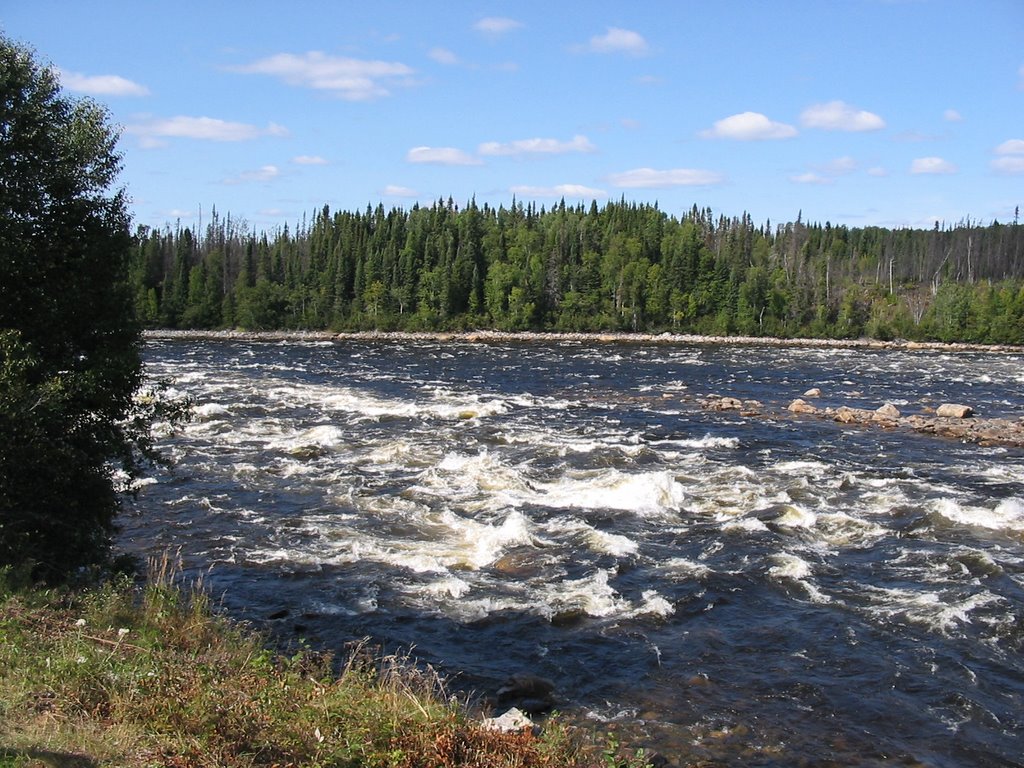
Soon after this we cross the Rupert River. Seeing the river is part of the reason for the trip. The Rupert flows like an artery across the middle of Quebec, emptying millions of gallons of fresh water into the bottom of James Bay. It is spine-shattering rapids and wide, sweeping swathes of water. It will be diverted next year for a hydro project. But for now it flows, and we were keen to see it in all of its majesty. It was literally breath taking.
As we looked out over the river we saw a campfire on a landing above the rapids. We then turned around to see a fellow casually strolling down the bridge toward us. In the middle of nowhere we met Benoit, a Frenchman now living in Trois Riviere. He regularly camps alone in Quebec’s wilds. We enjoyed his brief company immensely, and he obliged us and took a picture of Sam and me above the rapids.

We then pushed on for Nemaska, a native town at kilometer three hundred. We had traveled 700 kms by the time we arrived, and decided to call it a day. But first we rode across a narrow isthmus into the town and gassed up. David, the station attendant, told us we could stay on the beach of the narrows. He said normally we could stay on the beach at the other side of the town, but everyone was there for a wedding party. So we headed back out the narrows and found the most beautiful campsite. A beach ran along a bay on Lake Campion. We pitched our tent and set to making dinner. We soon welcomed what seemed like a parade of visitors. Each one stopped to make sure we were alright. A village elder named Sam offered us the hospitality of his home. We declined, but he did accept our invitation to tea. He told us the story of his birth, brought forth in the bush by the light of embers. The candles had run out. He told us how Nemaska had been built after Hydro Quebec flooded his old home. He told us of his camps all over the region, explained the Caribou and moose hunting seasons, answered all our questions about the local fishing. And then he moved on, but not before extending an offer of lodging again. His welcome warms me still.
Sam and I woke up early in Nemaska with all the narrows covered in fog. We could only take the locals’ word about the beauty of Lake Campion.
We made a quick breakfast and packed up the bikes. We would ride another 100 kms of gravel north west, and then meet the James Bay Highway at kilometer 275. Pushing along near top speed on the gravel we ate up the road in an hour’s time.
The JBH – North Road intersection

When we reached the JBH we had only 434 kilometers to Chisasibi. It is counterintuitive how the miles accumulate when you are this isolated. When you ride through a populated area every town and rest stop reminds you that you are traveling a long distance. But left with only long sweeping curves, burned out forests, small mountains in the distance and lake after lake, the distance becomes arbitrary. Instead, the mind is on holding the finest line through the corner and keeping the bike at top speed despite admonitions to drop to 85 km/h. The KLR is a fine bike, and bulletproof. But it’s on roads like the JBH – wide-open and unpatrolled – when I wish I had a bike that could easily cruise at 150 or 160 km/h, like this or this. All in good time.
About an hour after entering the highway we came upon Relais 381. It is a town – of sorts – at kilometer 381 of the JBH. It exists to pump gas at exorbirant prices and charge $1 for two day old hard boiled eggs. Sam says it’s the crappiest town in Canada. I reserve comment.
Relais 381 on the ride back
Fuel tanks filled, we took off at just after noon for Chisasibi. On the way we passed the Trans-Taiga road, a 700 km eastward ride into the middle of nowhere. At its end you lie farther from a town than on any other road in North America. We were taken by its isolation, and pointed the bikes down it. But time would not permit the trip this time.
The start of the Trans-Taiga

We arrived three hours later. A mostly native town, Chisasibi sits 90 kilometers west of the JBH on the La Grande river, just downstream from the great LG1 hydroelectric dam, and just ten kilometers upstream from James Bay. We pushed beyond the town looking for some trail to James Bay.
Somehow we ended up on ATV dual track which kept getting thicker and thicker, turning towards and then away from the river. When we decided this was not the way to the bay we turned around and started a back track. Anxious to get to the bay I kicked up the speed of the bike and upshifted a couple of times. Riding in deep ruts, this was a bad idea. It was only a matter of seconds before I hit a bad series of bumps and inadvertently hit the throttle. The bike rocketed ahead, then over, they into a tree. I ended up beside it and ahead of it. Laying on the trail I took a few deep breathes and gave everything the once over. Trailing not far behind, Sam inspected everything. I then made my way back to the bike, which fared better than the tree. The front wheel and fork where fine. Nothing was broken, and the mirrors but needed adjustment. At this point I got mad at Sam for not taking pictures of the crash. He wanted to make sure I was fine before snapping pics. That’s what friends are for, apparently.
The bike after the crash

Back at speed, we left the trail and then found the three lane wide dirt road which leads to the Bay. Apparently our observational skills match our navigational skills.
We passed a steady stream of pick up trucks and cars on our way to the Bay, and arrived after ten minutes. All the riding had been worth it. I cannot imagine a better scene. The water stretches past the horizon, the sky goes on forever, rocks come up from the water at low tide, and fishing boats and drying racks dot the shore. The flow of Le Grande is great enough that you can taste just a trace of salt in the water. We considered cooking dinner on the shore, but the air was getting colder and we knew we had a long ride to the Rupert River at km 257, where we hoped to spend the night. So we decided on dinner in Chisasibi and a long ride through the night to the Rupert. We’d never make it that far.
James Bay


After Sam and I left the shore we headed to Chisasibi for dinner. Food in our bellies, we would ride in the dark to the Rupert River at kilometer 257. For those counting, that’s 90 kilometers out from Chisasibi, and then 343 kilometers on the JBH.
On the way out of Chisasibi we took a quick detour to see LG1, one of the great hydroelectric dams of northern Quebec. My eyes don’t see well at dusk, so it was a fine time to get off the bikes for a few minutes. We soon discovered that we could ride across the top of the dam, and then to a viewing platform downriver. It is hard to capture the scale of the barrage, but it is 1.3 kilometers wide and 160 meters in height.
Downstream at Le Grande

LG-1

The sun completely down, we set off for the JBH. By the time we reached the highway I was freezing. The temperature had dropped close to freezing, which makes it several degrees colder at speed. We stopped to regroup, adding whatever layers we had. We also used the last of our heatpacks. It was ultimately all for not. Within 100 kilometers I could barely keep my legs from shaking, and my speed was dropping continuously, a tell-tale sign of fatigue. Soon after that I was convinced I could see frost on the trees, and the miles rolled by dreadfully slowly. What seemed like an hour would pass and we’d be just ten kilometers closer to our goal. The steady stream of northbound logging trucks soon proved a hazard, as I began to fear drifting across lanes, especially as it became more difficult to hold our lines through the corners. Then, at km 470, we hit a fog which swallowed our front wheels. It was only with good fortune that we were alongside Lake Mistanikap, dotted with Cree summer camps. We set up camp as quickly as we could. Chilled to the core, I slept in all my gear.
I woke up late the next morning. It had been an awful ride the night before. And today we had 1100 kms to home. Still, I looked forward to the challenge. Even when I pushed my head outside of the tent and proceeded to cough up a bunch of blood.
The camp in morning

We tried to be efficient in cleaning up camp, but the long night had gotten the better of us. Sam dropped his bike in the sand twice. I almost dropped mine once (and had dropped it twice the day before). But we soon resolved ourselves to the task and set out. We rode a hard pace to Relais 381 where we would gas up for our longest stretch yet without fuel. Then, filled up on some mixture of Red Bull, ginseng, and Gatorade, we headed for Matagami. It’s hardly heavy fuel, but it will keep you eyes up on the bike.
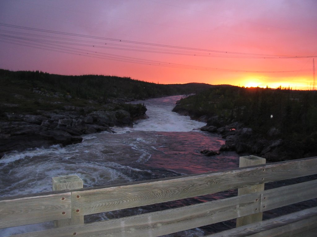
At km 257 we finally hit the Rupert. We had crossed it earlier on the North Road, but there the river was nothing like it is here. By the time the Rupert crosses the JBH is has collected much more water, as several more lakes spill into its stream. I had seen pictures before, but they did nothing to capture the scale of the rapids. It takes little to imagine the most calm line leading to smashed canoes. And it is inconceivable that one could run the roughest section of the cataracts. This is, quite literally, a deadly river. It is a kilometer of crashing. crushing rapids. There is nothing calm or serene about it. The Queen of the North, it is one of Quebec’s greatest possessions. As I’ve written below, this is not for much longer. Sam and I briefly discussed the merits of damming the river, given how much power it will provide and how much wealth will accrue to the Cree nations as a result. But it really doesn’t make up for the loss. We had little time to stay – we had to get back to jobs and studies. Life rolls on like the Rupert, apparently. Until it doesn’t.
The Rupert River

From the Rupert we rode a little less than 900 kilometers home. I rode about 80 more than Sam, on account of his bike breaking down in the Gatineaus. The cause remains unknown, despite he and I performing a number of simple tests on the roadside, guided by my dad on a cellphone. I ended up winding the last 80 kilometers home following a tow truck with Sam’s bike. It was a poor ending to an extraordinary trip, the thoughts of which keep flowing.


3 comments:
Some of these photos are just great. It reminds me of my time living with my father in up in Kuujuarapik.
I did this route by bicycle, on my way to Newfoundland. I can see how it could hold very little appeal, but I remember kilometre 381 fondly; good people who fed me well (difficult to carry enough food all the way to Radisson/Chisasibi without it) and a mechanic who worked there fixed my bicycle shoe. It's good to be reminded of riding from the 51st and the 54th parallel on that amazing road.
Your pictures looks amazing! Great quality, amazing views.
Post a Comment